NASA and other space agencies often stitch together satellite data to create a full image of Earth. This is not a conspiracy theory, it’s an openly acknowledged method. For example, the YouTube video titled “Our Blue Marble” posted by The Obama White House explains how images of Earth are created using satellite photo strips. Since most satellites orbit in narrow paths, they photograph Earth in slices which are later digitally combined.
True photographs of the entire globe in one frame are uncommon, and here’s why:
-
You need to be extremely far from Earth to fit the whole planet in one shot.
-
Only a few missions, such as the Apollo flights (questionable) and the DSCOVR satellite, have had that vantage point.
-
Most satellites are in Low Earth Orbit (LEO), which only lets them see small portions of Earth at a time.
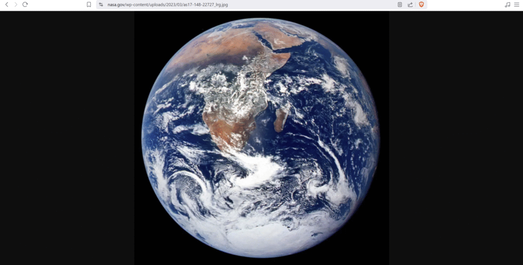
However, even the most famous full-Earth image, Apollo 17’s “Blue Marble” (1972) has not escaped scrutiny. Over the years, this image has appeared in slightly different forms. In the video below, I highlight side-by-side comparisons and concerns from researchers and citizens who point out repeated patterns and possible signs of digital editing.
Interestingly, the version of the Blue Marble hosted on NASA.gov today does not match older versions. NASA’s official website is built with WordPress, and WordPress includes upload dates in the URL of its media files. The most recent image of the Blue Marble on their site shows a timestamp of March 2023, shown below.

The above video also discusses broader concerns about planetary photography. It includes claims that some images of other planets are digitally created or enhanced, rather than authentic single frame captures. A particular focus is placed on a well-known photo of Earth from the Moon, where increasing the brightness levels in Photoshop reveals color fringing around the Earth. This has led some to speculate whether the planet was added digitally.
On the other hand, DSCOVR’s EPIC camera, launched during the Obama administration, is said to provide real-time full-disk images of Earth from approximately 1 million miles away, at a position called Lagrange Point 1. This orbit allows it to constantly face the sunlit side of Earth, offering what appears to be legitimate full-Earth photos without stitching.
While most mainstream scientists support the authenticity of DSCOVR’s images, and its position has been verified by amateur astronomers, some skeptics question the flawless appearance of these images and the lack of visible stars, citing Photoshop-like traits.
I don’t claim to have definitive answers but instead invite critical thinking. As we advance technologically, it’s important to remain curious, ask questions, and seek transparency in how our understanding of Earth is shaped, whether by lenses, pixels, or policies.
What do you think? Is our view of Earth through the eyes of space agencies truly transparent, or are we being shown what they want us to see?